
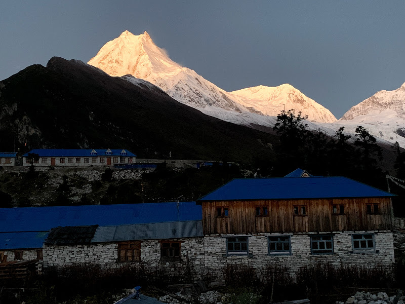
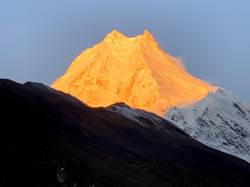
Manaslu Circuit Trek is one of the best treks in Nepal to around Mt. Manaslu (8163m), the world’s eighth highest peak.
This 18 day Manaslu Circuit Trek includes the cool and peaceful valleys and lowlands to the high around Manaslu. The trail offers outstanding views of Manaslu, Annapurna, Gangapurna, Himal Chuli, Ganesh Himal, Himlung, Kang Guru, and many other peaks. The trek begins from following the Budhi Gandaki River and passes through cultivated fields, subtropical forests, and deep gorges to climb up to the Larke La Pass (5167m), the highest point on the trek. On the way, you will have a chance to witness some of the Himalayan wildlife including Tahr (Mountain Goat), Agali (Blue Sheep), Pika (Highest living Mammal), Himalayan Marmots, and even Snow Leopards.
The Manaslu Himal rises in the north of the Gorkha District in mid-western Nepal. The region includes some of the most beautiful and dramatic scenery in the Himalayas. In the south, we find Hindu Newars and Buddhist Gurungs. The north is the home of old Gurung and a Tibetan community who speak two independent dialects.
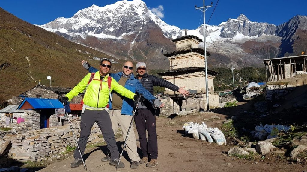
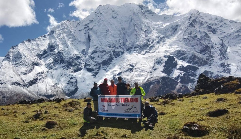
This 170km trail is up and down and calls for good initial fitness. The up route passes through natural forest. The valley gradually curves to the west between dramatic mountain ranges to the north and south beyond ‘New Bridge’. On the 8th day, Manaslu is first revealed. A rest day at Samagaon includes a visit to the Pungyen Nunnery below Manaslu or a walk to Manaslu Base Camp. A three-day trek, then, leads to the Larkya La (5 160m/16 930ft) beyond which the trail drops into the Annapurna Region through dramatic glacial scenery to warmer villages below. Before taking a jeep back to Kathmandu, we will descend to Tal for the last night.Tsum Valley Trekking
Overview
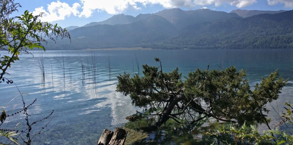
Manaslu Circuit Trek is one of the best treks in Nepal to around Mt. Manaslu (8163m), the world’s eighth highest peak.
This 18 day Manaslu Circuit Trek includes the cool and peaceful valleys and lowlands to the high around Manaslu. The trail offers outstanding views of Manaslu, Annapurna, Gangapurna, Himal Chuli, Ganesh Himal, Himlung, Kang Guru, and many other peaks. The trek begins from following the Budhi Gandaki River and passes through cultivated fields, subtropical forests, and deep gorges to climb up to the Larke La Pass (5167m), the highest point on the trek. On the way, you will have a chance to witness some of the Himalayan wildlife including Tahr (Mountain Goat), Agali (Blue Sheep), Pika (Highest living Mammal), Himalayan Marmots, and even Snow Leopards.
The Manaslu Himal rises in the north of the Gorkha District in mid-western Nepal. The region includes some of the most beautiful and dramatic scenery in the Himalayas. In the south, we find Hindu Newars and Buddhist Gurungs. The north is the home of old Gurung and a Tibetan community who speak two independent dialects.
This 170km trail is up and down and calls for good initial fitness. The up route passes through natural forest. The valley gradually curves to the west between dramatic mountain ranges to the north and south beyond ‘New Bridge’. On the 8th day, Manaslu is first revealed. A rest day at Samagaon includes a visit to the Pungyen Nunnery below Manaslu or a walk to Manaslu Base Camp. A three-day trek, then, leads to the Larkya La (5 160m/16 930ft) beyond which the trail drops into the Annapurna Region through dramatic glacial scenery to warmer villages below. Before taking a jeep back to Kathmandu, we will descend to Tal for the last night.
Best Season for Manaslu Circuit Trek
The best time of the year is March to May(during spring) and last week (in September to mid-December during autumn). The peak season is October. During these seasons, the weather is good and therefore, suitable for visiting.
Manaslu Circuit Trek Difficulty
Manaslu Circuit Trek needs physically fit into the remote parts of western Nepal. For this trek, little to no prior trekking experience, good fitness levels, and abundant stamina are highly recommended.
Manaslu Circuit Trek Itinerary
Day 01: Arrival Welcome at Kathmandu Tribhuvan Airport (1 300m/4 260ft). Day 02: In the City UNESCO World Heritage Sites Included (Kathmandu Durbar Square, Pashupatinath, Swayambhu, Boudhanath)OR A day at leisure. Trek preparation.
Day 03: Drive Kathmandu – Arughat (670m/2 200ft) – Soti Khola (710m/2 330ft), 135km, 8-9 hrs drive
Day 04: Trek Soti Khola – Machha Khola (890m/2 920ft), 6-7 hrs
Day 05: Trek Machha Khola – Dobhan (1 000m/3 280ft), 6-7 hrs
Day 06: Trek Dobhan – Philim (1 590m/5 216ft), 6-7 hrs
Day 07: Trek Philim – Deng (2 360m/7 750ft), 6-7hrs
Day 08: Trek Deng – Namrung (2 660m/8 730ft), 6-7 hrs.
Day 09: Trek Namrung – Lho (3 180m/10 430ft), 4-5 hrs
Day 10: Trek Lho – Samagaon (3 530m/11 580ft), 5-6 hrs
Day 11: Sama: Rest and exploration day: Birendra Tal / Pungyen Gompa / Manaslu Base Camp
Day 12: Trek Samagaon – Samdo (3 860m/12 660ft), 3-4 hrs
Day 13: Trek Samdo – Dharamsala/Larkya Phedi (4 460m/14 630ft), 3-5 hrs
Day 14: Trek Dharamsala – Larkya La (5 160m/16 930ft) – Bimthang (3 720m/12 200ft), 7-9 hrs
Day 15: Trek Bimthang – Gho (2 560m/8 400ft), 5-6 hrs
Day 16: Gho – Dharapani (1 920m/6 300ft) – Tal (1 700m/5 580ft) 3-4 hrs
Day 17: Tal – Besi Sahar (760m/2 495ft) – Kathmandu (1 300m/4 260ft), 190km, 7-8hrs drive
Day 18: Final Departure: Transfer to Tribhuvan International Airport for your flight to your onward destination.
Important NOTE:
- Above mentioned itinerary is subject to change depending on the weather conditions, the health of the visitors and/or guide, natural conditions, and other circumstances. But our key concern is always guest satisfaction. So we will always try for maximum benefits from unfavorable conditions also.
- The facilities and hotel services are set based on your budget and request. So the tour/package charges are conditional as per your demand.


Recent Comments